
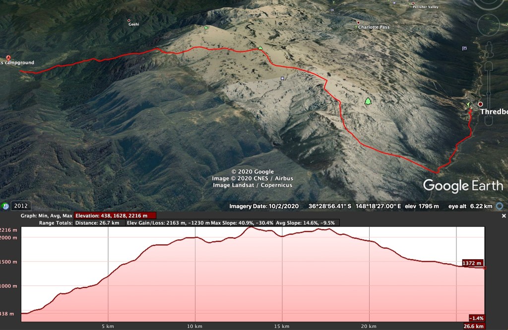
On recent ski tours in Australia’s Snowy Mountains, we’d heard talk of the “real” route to the top of Mt Kosciuszko from Geehi Flat up Hannel’s Spur had been recently re-cleared. This is supposedly an ancient Aboriginal route that was used by early European explorers and cattle graziers to access the high alpine. Our group locked in some dates in late November 2020 to traverse the main range from 380m above sea level at Geehi Flats to the top of Mt Kosciuszko at 2228m and back down to Thredbo at 1365m, apparently the highest continuous vertical ascent possible in Australia.


Our original plan was to spend two nights and three days walking the roughly 27kms across the range to Dead Horse Gap and back down the river to Thredbo. This meant carrying a full camping kit and food in packs that weighed 12-15kgs without water. As the first running water on the route is available at Moira’s Flat after the first 1100m of vertical climb over 7.5km of distance from the drop off point, everyone carried three litres of water, taking total pack weights to around 15-18kgs. We all carried wet weather gear given the forecast was variable, but packed lighter thermal clothing and sleeping bags, as the temperatures were unlikely to drop much below 10ºC. We all wore leather hiking boots and used hiking poles – essential gear on the steep, rough trails with heavier packs.
Our group was aged from late twenties to late forties with good to excellent fitness and a lot of multi day hiking experience between us. Where group members had done specific pre-trip training, this was focused on a few prior weeks of regular long hill climbs with a weighted pack. Anyone considering this walk needs to be confident of having the stamina to walk a minimum 4-6hrs uphill with a ~15kg pack, as this is critical to reach the first potential camp site and running water at Moira’s Flat. Completing the route in a single day takes at least 10-12hrs to cover the full ~23km to the bottom of Thredbo via the Main Range Track, with many people attempting this exiting in the dark.
Leaving our car at Thredbo, we booked a shuttle drop to Geehi Flats on a sunny Saturday morning and crossed the Swampy Plain river to Forbes Hut at 9am to put our boots and gaiters on and hit the trail. The trail head is clearly marked with a National Parks sign after a few hundred metres across a grassy field, and the uphill hiking begins.
The first ~3kms is a sustained steep climb, followed by a meandering plateau for ~1.5kms before a final ~2kms of more steep trail up to Moira’s Flat at ~1550m vertical. The trail is well marked and formed along this section, with a few fallen trees to get around, over or under. There was only one moment where a false trail led us uphill for 50m in the wrong direction, but overall it’s very easy to follow. Despite being steep, the walking is relatively easy on a soft, leaf litter covered trail.
One thing that other trip reports don’t focus on is how amazing the forest is through this first section – huge old growth Mountain Ash trees interspersed by wild flowers and myriad bird species chirping away. The tree cover provides excellent shade on the majority of the ascent, and the vegetation goes through distinct changes as you ascend, often quite abruptly.
We arrived at Moira’s Flat at 1pm after 4hrs of walking for a well earned lunch and water refill. The creek is easy to find via the sign posts and was clean and flowing well on our visit. Just keep an eye out for some big snakes near water sources – we were greeted by an Eastern Brown snake at Moira’s Flat and passed a grumpy Copperhead in the high alpine.
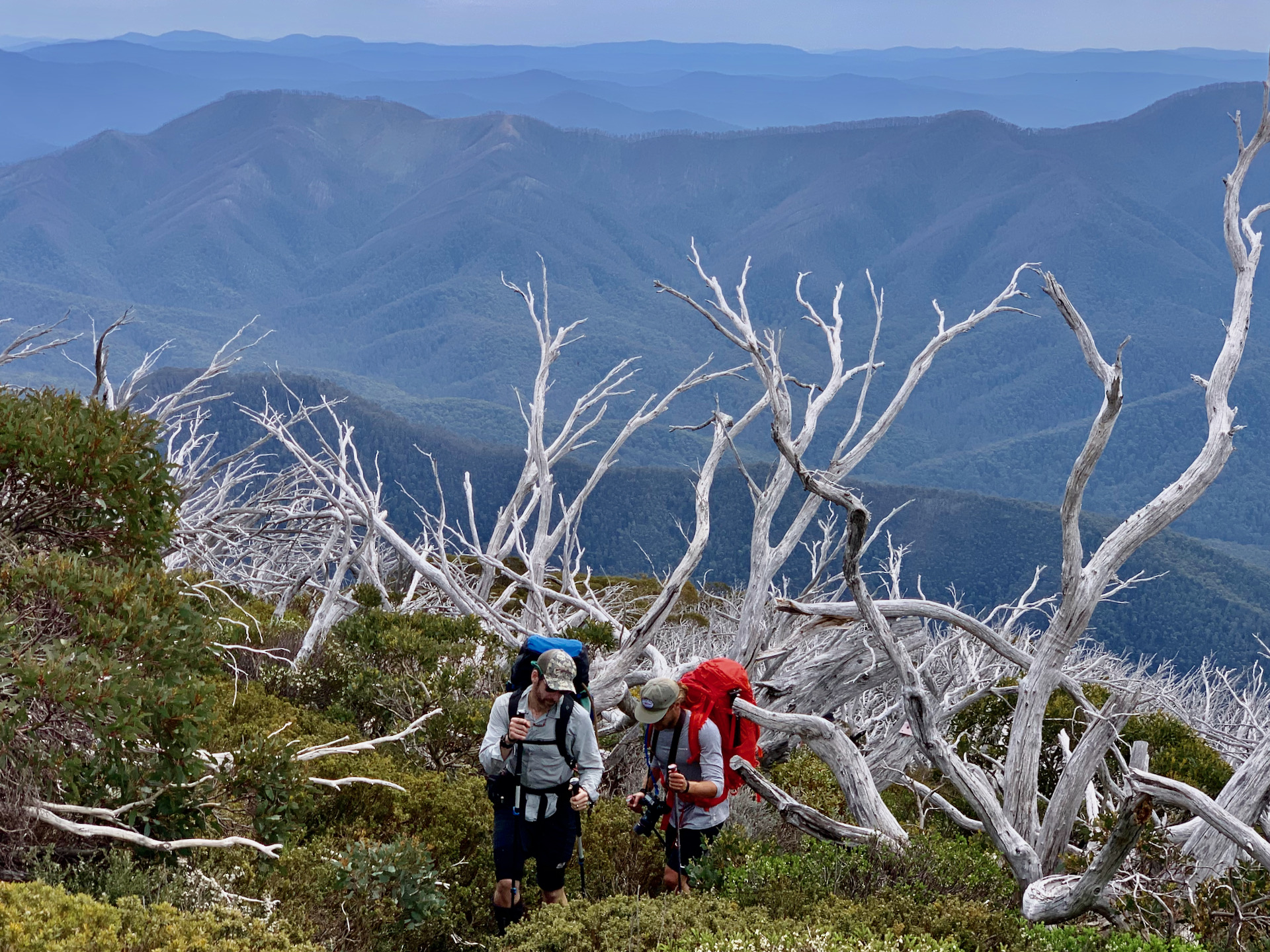
The second section of the spur track was cleared in 2018 and would be completely impenetrable without a defined route. The vegetation thickens quickly above Moira’s Flat into dense undergrowth with a lot of fallen timber of trees killed in the 2003 fires and flattened by recent heavy snowfalls. While only about 2km in distance, the path here is the steepest and narrowest section and could do with another pass through with a chainsaw and brush cutter. Despite this, the impetus to get above the tree line was strong, so within a bit over an hour we were up at Byatt’s camp.
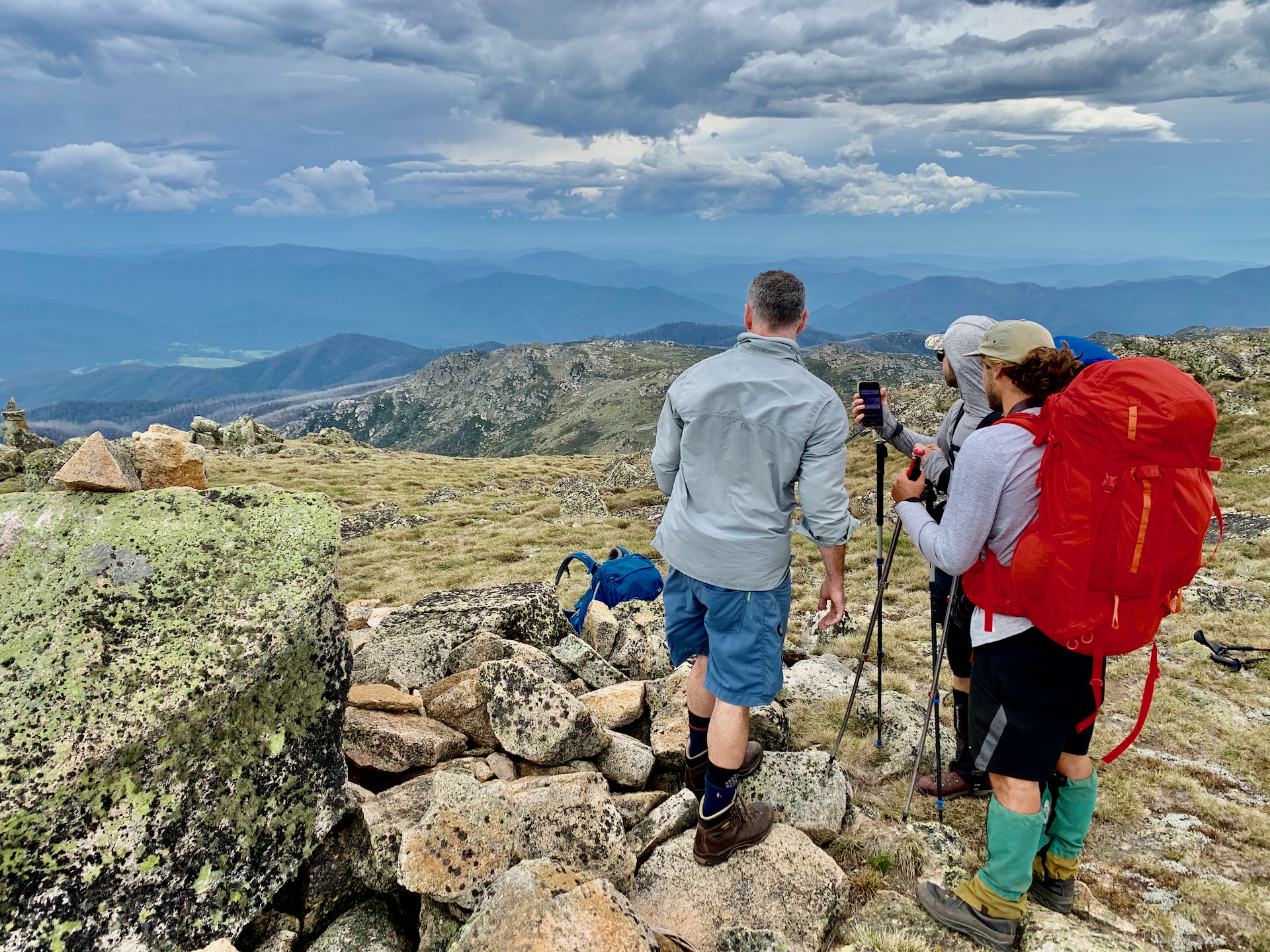
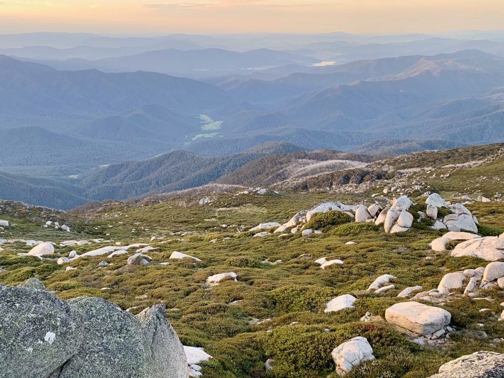
There’s plenty of water in the Byatt’s Camp stream, but the camping area is a hundred metres or more away across brambles and heath and the view is a bit hemmed in by the ridge lines. We decided to press on to Abbott Ridge and found a nice clear grassy area near a stream for our first night’s camp. This provided us with almost 360 degree views from Mt Jugungal in the North to Mt Kosciuszko and Rams Head in the South East and a spectacular vista for the evening’s sunset over Mt Bogong and the Victorian Alps. All up, we’d hiked 12.5kms up 1550m of vertical in 6.5 hours on day one.

Another bonus of this camp site was reasonable mobile reception (Optus), that we’d also had most of the way up Hannel’s Spur. This helped us keep tabs on the forecasts, satellite and radar imagery for incoming weather and post some updates on social media.
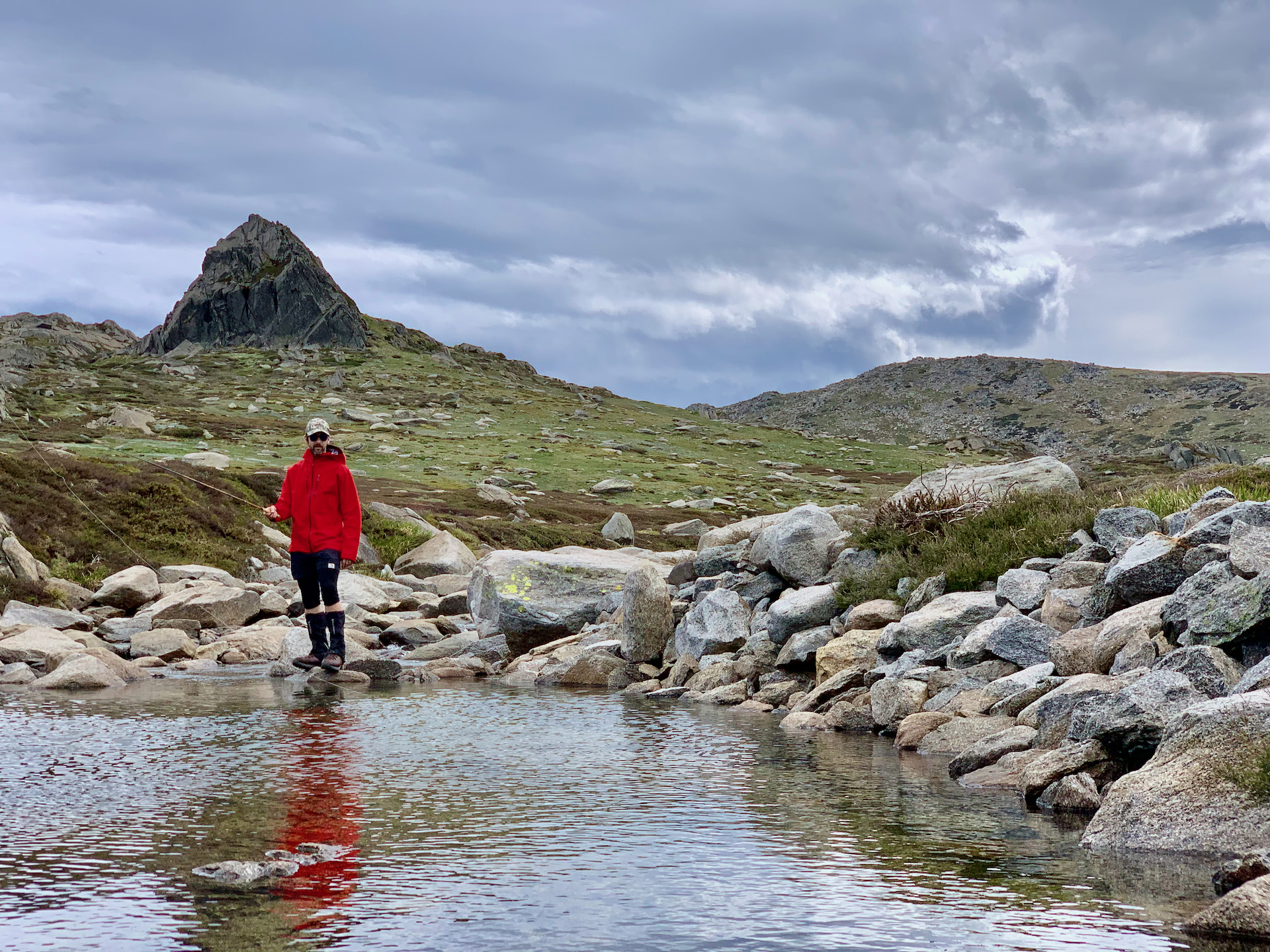
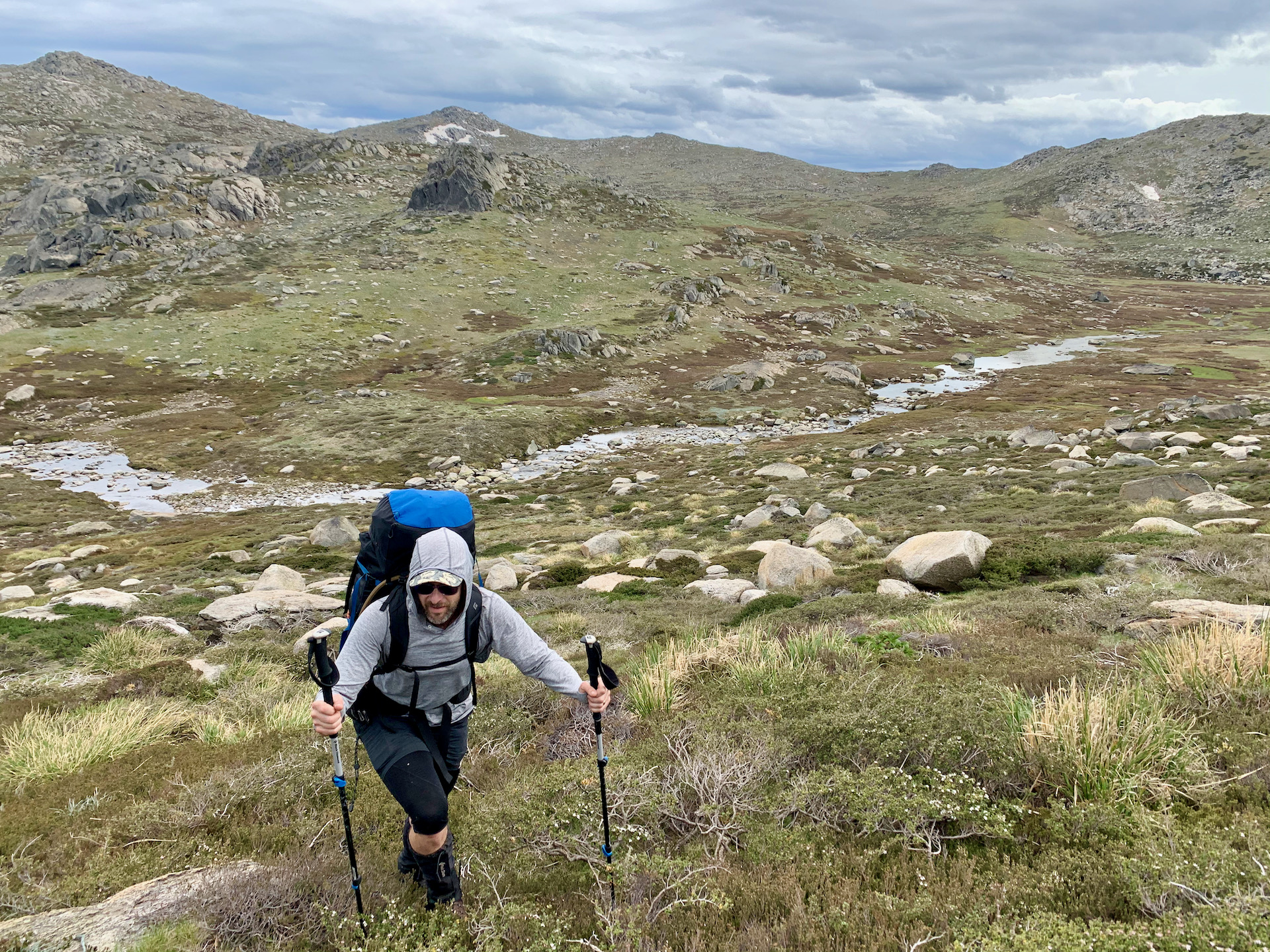
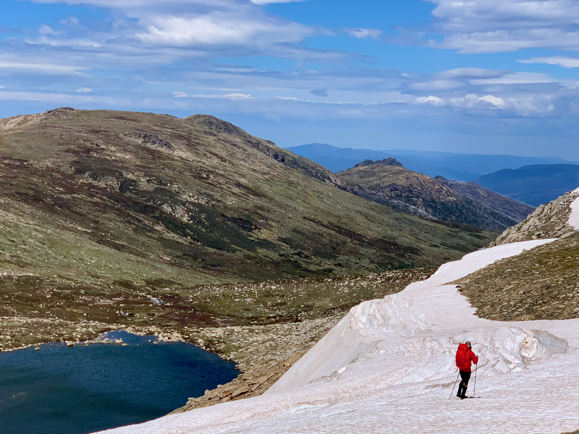
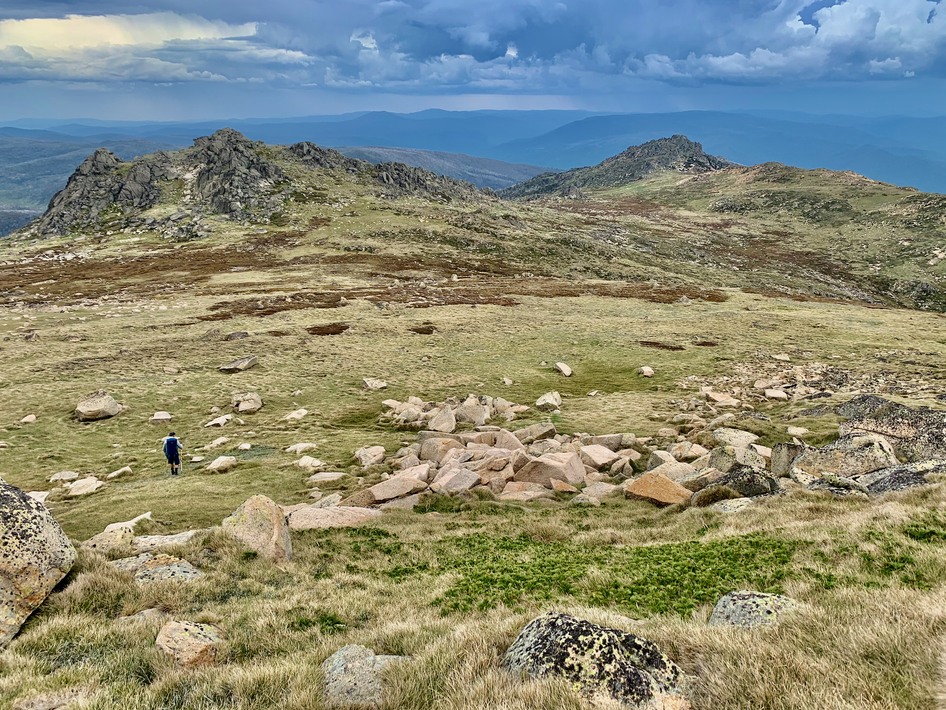
Waking up to a few drops of rain on Sunday morning, we decided to head over Wilkinson’s Creek and up the west face of Mt Kosciuszko before traversing the ridge line down below Lake Cootapatamba and out across the Rams Heads to Dead Horse Gap. With a bit more time, we would have liked to include a traverse around Mount Townsend and Muellers Peak that would have added another 4kms to the route. This was all easy navigation through heath and alpine grasses with two main peaks to tag along the way. If the weather had started closing in when we summited Kosciuszko, we had the option to exit via the Main Range Track back to the top of Thredbo’s chairlift for a hasty retreat.
By the time we reached South Rams Head we did see a thunderstorm about to hit, so took shelter in a small cave to ride it out. It ended up being quite a bit more intense than anticipated, but cleared within an hour, leaving us to route find down to Dead Horse Gap through sodden undergrowth.
Rather than set up camp for a second night and walk out in Monday morning’s forecast rain, we decided to push the final few kilometres back to Thredbo for a bistro dinner and hot tub back at the lodge. This meant our second day distance was around 16km with another 600m vertical ascent before descending almost a kilometre of vertical back down to Thredbo.
Overall, the Hannel’s Spur traverse to Thredbo is easily one of the most spectacular walks in Australia, taking in a huge variety of terrain and breathtaking views on a challenging trail.

Great report Owen.
As expected.
Thanks for another great mission.
LikeLike